InTDS ArchivebyFlorian TrautweilerHow to Process 10k Images in SecondsEfficient image operations with multiprocessing in PythonJan 25Jan 25
InTDS ArchivebyDr. Carmen Adriana Martínez BarbosaSegmenting Water in Satellite Images Using PaliGemmaSome insights on using Google’s latest Vision Language ModelDec 29, 2024Dec 29, 2024
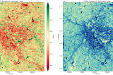
Tarık Emre YorulmazUse of Geoinformation Technologies in Flood AnalysisFloods are among the most common and devastating natural disasters worldwide. These disasters cause both loss of life and major material…Nov 2, 20241Nov 2, 20241
InPython in Plain EnglishbyKokaTicUnlocking the Power of Python: Top GIS and Remote Sensing Libraries for Data AnalysisA Comprehensive Guide to Python Libraries for Spatial Data and Remote Sensing ProcessingOct 3, 20241Oct 3, 20241
InGoogle Earth and Earth EnginebyGoogle EarthEarth Engine V1 Python Library LaunchedBy Justin Braaten, Google DevRel, on behalf of the Earth Engine front end teamOct 8, 20242Oct 8, 20242
PETER NDIRITU THUKUCase Study : NDVI CALCULATION ON GOOGLE COOLAB & GOOGLE EARTH ENGINEStudy Area : KenyaJun 16, 2023Jun 16, 2023
Palash MishraPredicting Time Series Data with Machine Learning, Generative AI, and Deep LearningTime series data prediction is a critical aspect of various industries, ranging from finance and healthcare to marketing and logistics. The…Jun 19, 202410Jun 19, 202410
InTDS ArchivebyMahyar Aboutalebi, Ph.D. 🎓Creating a Streamlit App for Satellite Imagery Visualization: A Step-by-Step GuideExplore any point on Earth at any time using satellite data with StreamlitJun 21, 20242Jun 21, 20242
PETER NDIRITU THUKUAn Introduction to Spatial Datacubes & OpenEO Python ClientLets get started ;Apr 28, 2024Apr 28, 2024
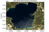
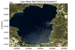
InTDS ArchivebyMahyar Aboutalebi, Ph.D. 🎓A Simple Way for Downloading Hundreds of Clipped Satellite Images Without Retrieving the Entire…Learn how to download a clipped Sentinel-2 image for any Area of Interest (AOI), Lake Tahoe here, with just 12 lines of script.Apr 26, 20242Apr 26, 20242
InAi2 BlogbyPiper WoltersSatlasPretrain Models: Foundation Models for Satellite and Aerial ImageryWe’re excited to announce SatlasPretrain Models, a suite of open geospatial foundation models. Accompanied by their source code…Apr 23, 2024Apr 23, 2024
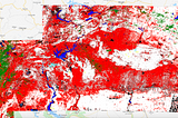
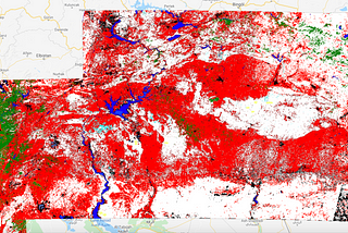
GeoNextThe Power of SAR Data and Google Earth Engine in Flood Area MappingBy Krishnagopal Halder, Student of Geoinformatics, Modern GIS Geek, ML EnthusiastOct 26, 20231Oct 26, 20231
GeoNextGetting Started with Microsoft Planetary Computer STAC APIBy Krishnagopal Halder, Student of Geoinformatics and Remote Sensing, Geospatial Geek, ML Enthusiast.Mar 19, 20242Mar 19, 20242
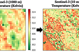
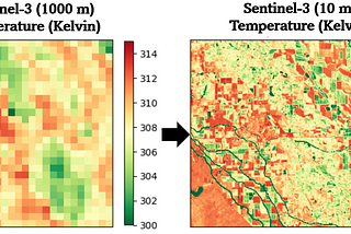
InTDS ArchivebyMahyar Aboutalebi, Ph.D. 🎓Downscaling a Satellite Thermal Image from 1000 m to 10 m (Python)Thermal Sharpening of Sentinel-3 Images: From 1 Km to 10 m Using Python in Google ColabMar 6, 20244Mar 6, 20244
Aleksei Rozanov6 python libraries to make beautiful mapsAt some point any Data Scientist faces the need to analyze or model geo spatial data, and it can’t be done without the crucial visual part…Feb 10, 202414Feb 10, 202414
ODSC - Open Data ScienceBuilding GeoAI with Lego-Like Simplicity Through Visual ProgrammingEditor’s note: Lingbo Liu, PhD is a speaker for ODSC East this April 23rd-25th. Be sure to check out his talk, “Workflow-based GeoAI…Mar 1, 2024Mar 1, 2024
InTDS ArchivebyGuilherme M. IablonovskiAutomating the hunt for illegal dumpsites in Turkey with satellite imageryImage classification with Google Earth Engine for the UNAug 12, 20205Aug 12, 20205
InRotten GrapesbyKrishna G. LodhaDownload Sentinel Data within seconds in pythonCheckout this blog to understand how we can use stac specification and it’s implementation in python to get Sentinel data quicklyFeb 6, 20241Feb 6, 20241
InTDS ArchivebyParvathy KrishnanAccessing and Visualizing Digital Elevation Models with PythonA tutorial in Python with openly available DEM dataMar 5, 20232Mar 5, 20232